In this post I hiked the MillSite trail and attempted to find the location of the Gilpin caboose photo shown below. I also attempted to locate the Gilpin Tramway engine shed. This is part of my series on hiking the Gilpin Tramway.
Original Photo
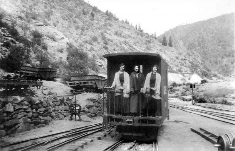
This photo was taken circa 1890-1917. It shows 3 women standing on the back of the Gilpin Gold Tram caboose number 400. The Gilpin only had one caboose. The photo is looking north away from the engine shed. This area is located across highway 119 from the current day parking lot that provides access to the Maryland Mountain park. Notice how few trees there are on any of the hill sides.
Current Photos
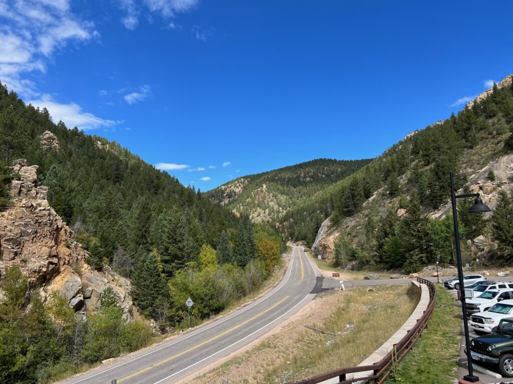
This photo was taken from the bridge over Colorado Hwy 119. Notice the distant mountain ridge intersecting Maryland Mountain on the left. Compare this to the historical caboose photo above.
In this photo I’m standing on the shoulder of Hwy 119. This seems to match the distance to the mountain ridges when compared to the historical photo. It also seems to be at almost the same elevation and angle as well. The historical photo was taken from a location on the other side of hwy 119 which is in the wooded area on the left of this picture. I could have crossed the highway but the trees would have blocked any meaningful view of the ridge lines.
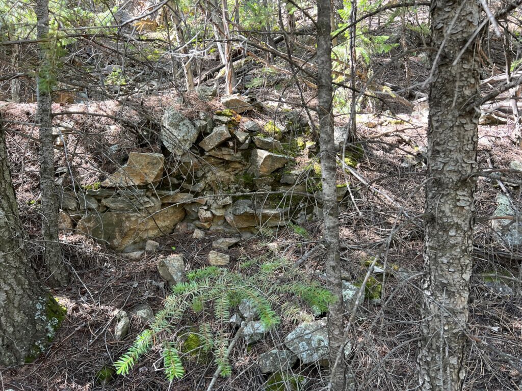
We hiked the Millsite trail which you can read more about here. Once we got down close to the creek I went off trail looking for the location of the engine shed. I hiked through the woods until I reached the large rock outcropping where the engine shed once stood. There was no evidence of the structure which is not surprising, but I was hoping to find remnants of the concrete foundation but no luck there either. I did find the rock wall shown above which may have been part of the rock wall separating the car storage tracks you can see on the left side of the historical photo.
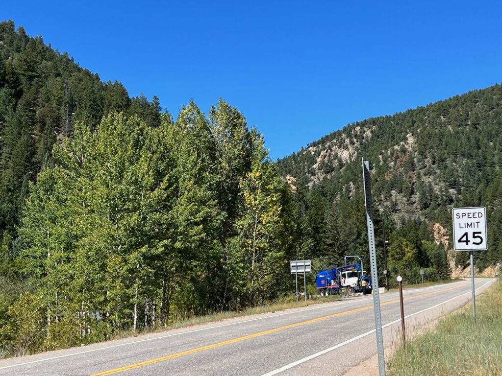
In general, the lay of the land seemed to match the historical photos with different level areas stepping up away from the creek. You could imagine the leads to the engine house where the caboose is located and the car repair tracks up above (where the ore cars are in the photo). I tried taking photos of the general area but it is so deeply wooded now that you really can’t get a sense of what you’re looking at. It’s like taking pictures of mountains, it just doesn’t do them justice.
Photo Locations
This is a portion of my AllTrails map for the Mill Site trail.
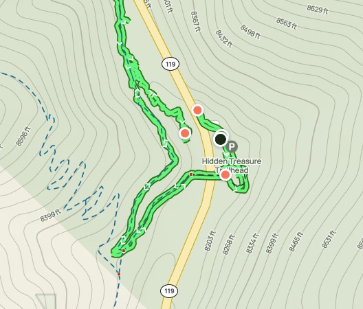
The black dot is where we parked. The red dot above the black dot is where I walked down to hwy 119 and took that photo. Once we started towards the trail, you see the red dot below the black dot which is the photo from the bridge that goes over hwy 119. Finally, the red dot at the end of the green trail is where I took the photo of the rock wall remnants. This is very close to the location of the Gilpin caboose photo.
And Finally…
Thanks for visiting my site. If you are interested in more Gilpin Gold Tram hikes then check out all my posts on the subject.